Volcano sight seeing tips
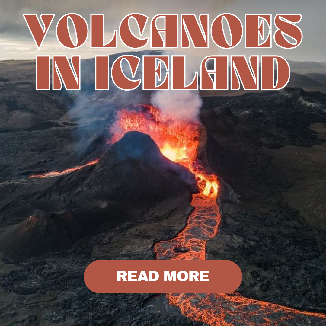
Guide to active volcanoes and Litli-Hrútur's site
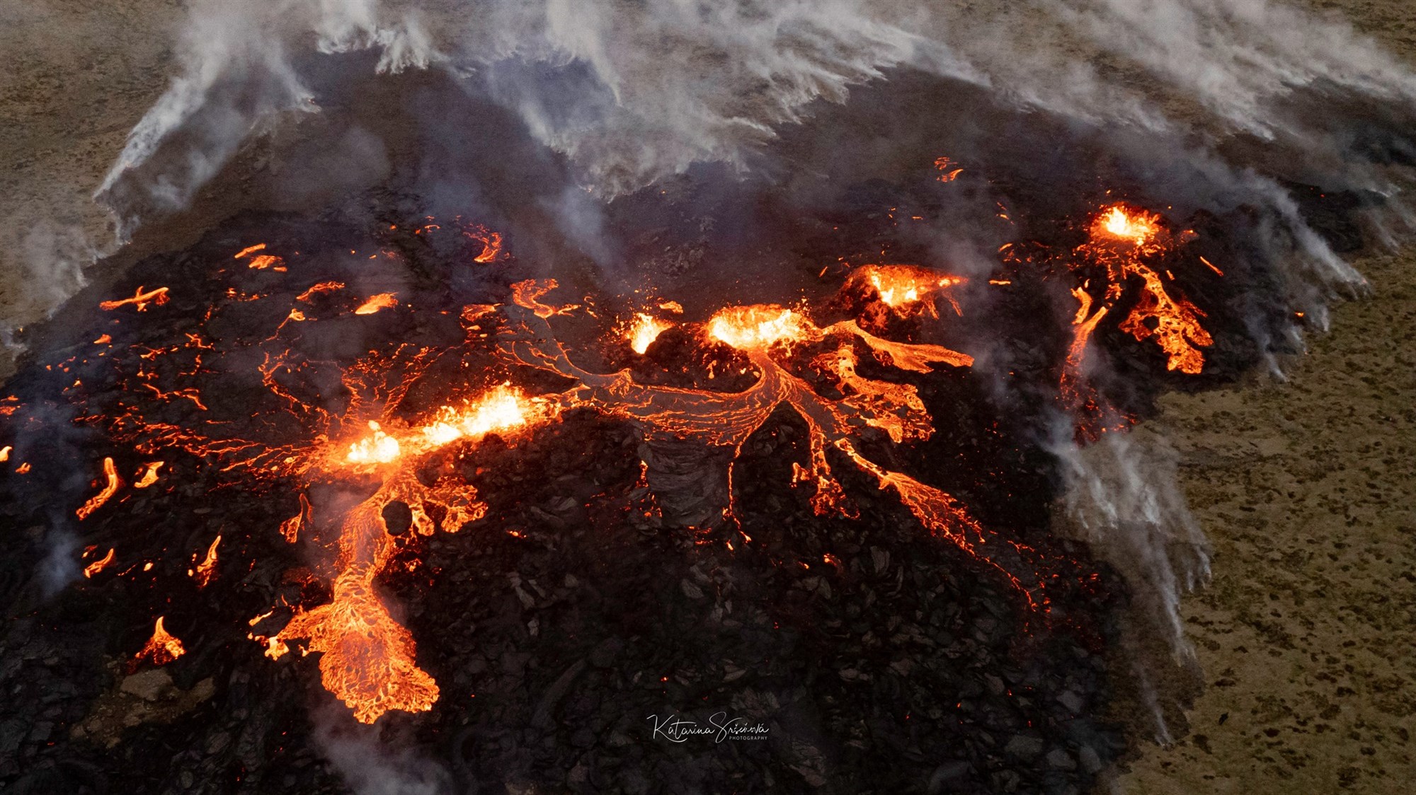
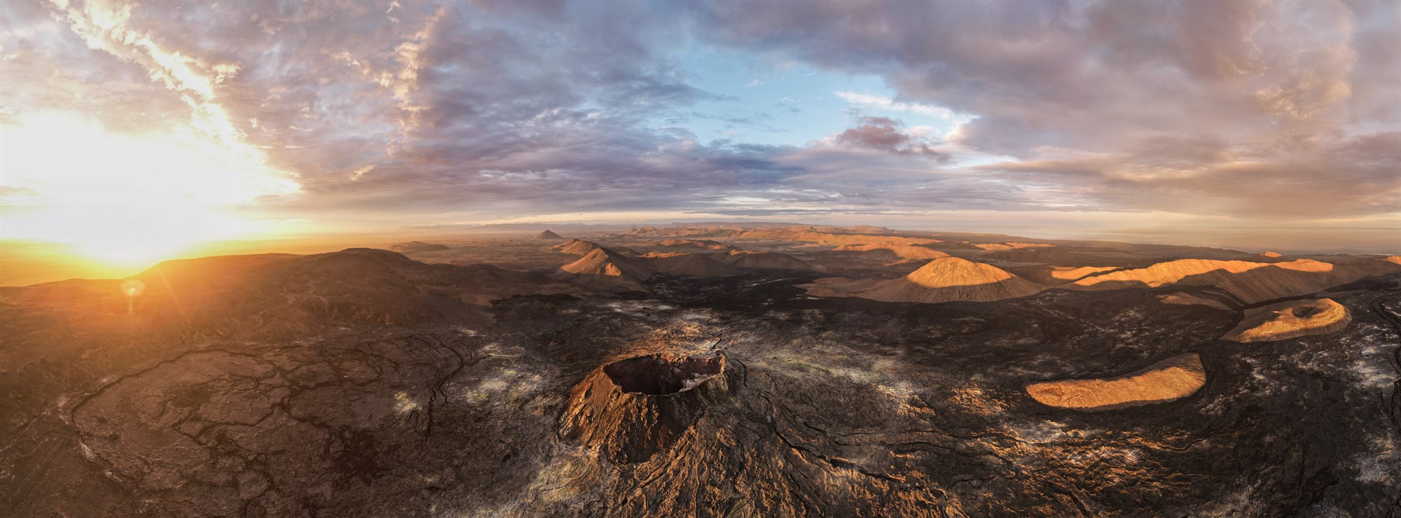
On July 10/2023 at, a 900 meter volcanic fissure was created in the south of Iceland, in Reykjanes Peninsula and near the capital city of Reykjavik.
It is a region recognized by a lot of geologists as an area with strong geothermal and geological activities. Fun fact, 42% of the volcanoes on Iceland are from this zone. It’s also shown by the recent events such as the 2021 eruption in the valley of Geldingadalir, the 2022 eruption, which are only from 1km away, in the valley of Meradalir or the one we talk about from 2023, the Litli-Hrútur eruption. The three of them are from the Fagradalsfjall Volcano system.
By now, the eruption is covering more than 1.2 km² which is more than the two previous eruptions ! Big up to the manager of KúKú Campers who jumped in her campervan after hearing the news to take beautiful pictures of the site (see below).
Hundreds of people have already made the walk to view the eruption or taken sightseeing helicopter rides to marvel at the volcanic eruption from the ground and the air.
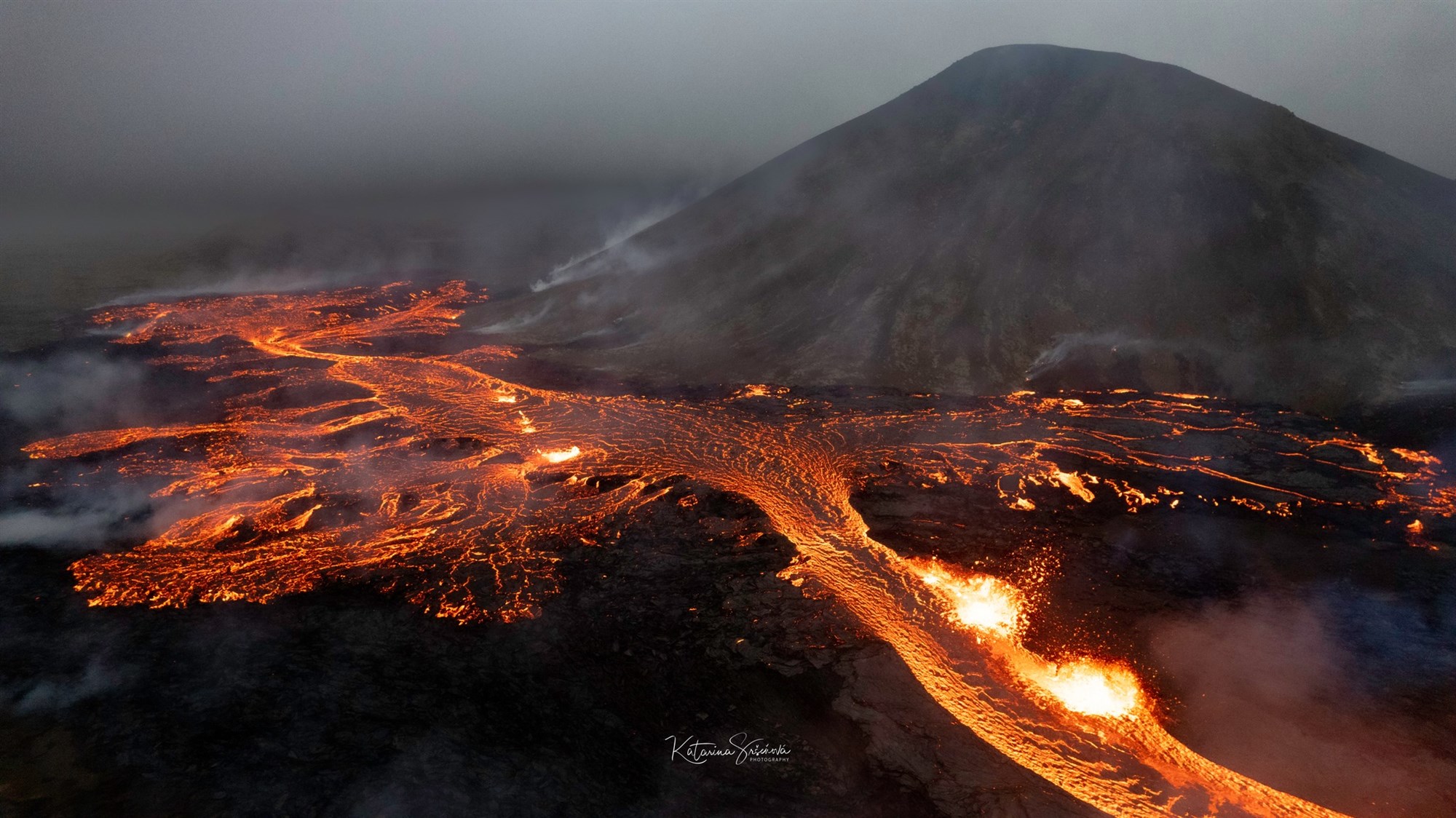
There will be no impact on air traffic or flights as this volcano is an effusive type, a distinct type of volcano known for its calm and gentle eruptions, which are characterized by the flow of lava. Unlike the explosive volcanoes that emit vast amounts of gas, ash, and volcanic projectiles into the sky which are really dangerous, effusive volcanoes primarily release fluid lava that streams out of the volcano's vents, spreading across the nearby terrain in a relatively smooth manner. These eruptions are less hazardous in the immediate sense, as the lava flows typically move at a slower pace, giving people more time to respond and evacuate if necessary but it is still really fascinating!
You can have all the informations related to volcano eruption in Iceland since 10 000 years on this website :
At KuKu Campers, we have made a short list of how our KuKu customers can drive their campervan to get to the site, what to wear, what to be aware of, and where to camp after a day of hiking - enjoy!
How to access the volcano site
- By campervan

To explore the volcano safely, the recommended options are to join a guided tour operator or travel by car. The eruption site's parking lots are situated an hour from Reykjavík and 30 minutes from Keflavík Airport by car. It's important to note that public transportation is not available to reach the site.
There are two paying parkings, named P1 and P2, with a fee of 1,000 ISK, which covers a 24-hour period. Payment is made electronically, and detailed instructions are provided at the parking lots. For the best experience during the hike, it's advisable to choose the P2 by the way.
- From Keflavík : Take road 41 towards Reykjavík, turn right on road 43 towards Grindavík and follow road 427 until you see the parking signs OR take road 41 towards Reykjavík, turn right on road 44 towards Hafnir, continue on road 425 towards Grindavík and follow road 427 until you see marked car parks.
- From Reykjavík : Take road 41 towards Keflavík, turn to road 43 towards Grindavík, and follow road 427 until you see the marked parking lots.
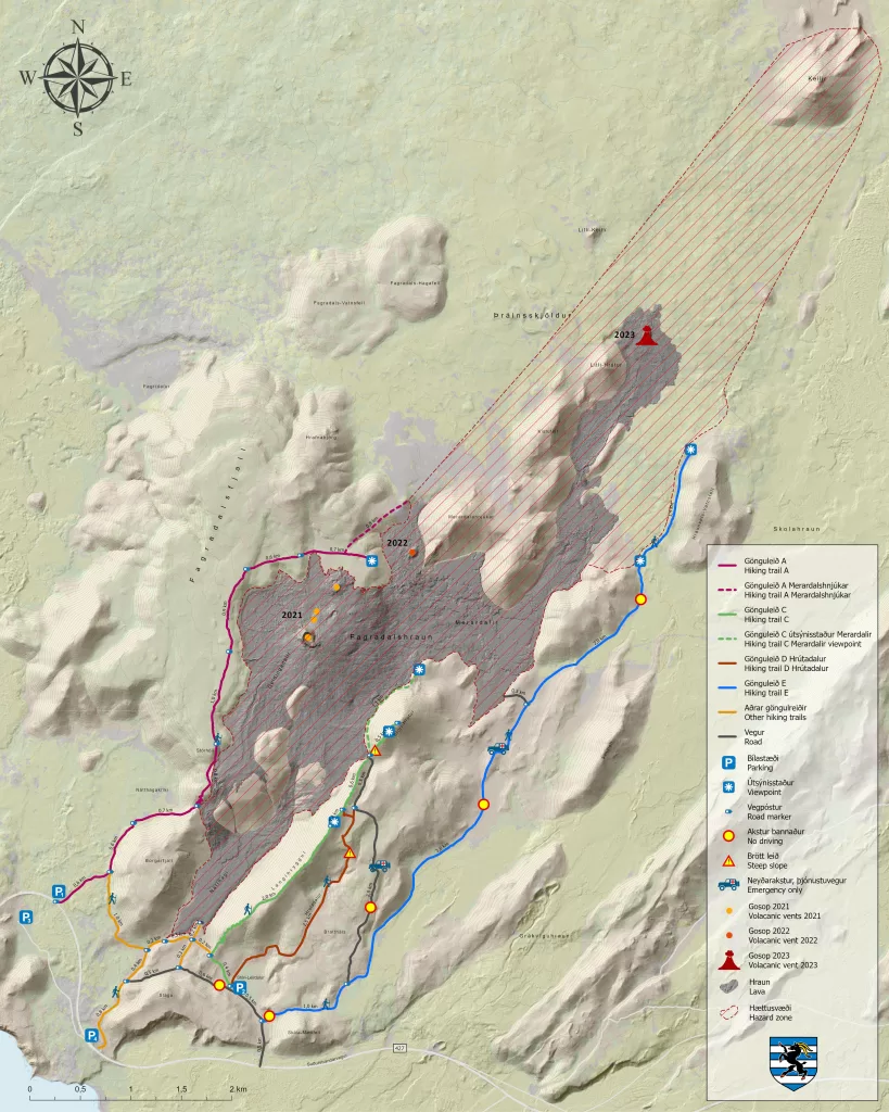
See the exact location of Geldingadalir Volcano on Geldingadalir Volcano map.
What to be aware of on a hike to an active volcano
First of all, you need to be aware of the weather, the optimum weather is a clear sky, southerly light wind. Check out the daily weather conditions for hiking to a volcano in Safe Travel Iceland.
Notice that the gases coming out of the volcano can be dangerous, you absolutely have to avoid the smokes coming out of the volcano, as they can cause severe damages to your lungs and health. Hence you need to check the wind very carefully to know whether or not you can hike. If the wind is coming from the south or the south-east, then you can hike to the volcano following the itinerary marked on this hiking map. You can check out the daily gas dispersion forecast Iceland weather forecast.
Part of the hiking trails are marked, but since the eruption just started, most of it isn't marked at all, so be careful in order not to get lost, as the hike can become a bit difficult on this challenging terrain. The path goes over lava fields, gravel, and uneven ground.
A return trip takes approximately 2-4 hours for hikers in pretty good shape, adding a stop at the site and a picnic break can easily turn into a 6-8 hour trip.
Please be careful when walking on old lava, as the lava from the eruption is still pretty fragile in some places, or even still hot. Avoid to walk on it as much as possible. If you see smoke coming from solidified lava, turn around.
Map of the hiking trails:
Hiking gear
Good hiking shoes, warm clothing, wind, and waterproof outerwear layers, hiking rods, a fully charged mobile phone as well as drinks and snacks adn you are ready to conquer the Litli-Hrútur's volcano !
Now let's hit the road !

You might also like...